River Level Monitoring: JWrada® Radar Level Transmitter with Horn Antenna & Solar Power
In river level monitoring and urban hydrological monitoring systems, the JWrada® radar level transmitter with horn antenna and solar power supply ensures data stability, which is directly related to flood control scheduling and overall city safety. Once water level data becomes unstable or misinterpreted, it may affect the decision-making of the entire early warning system.
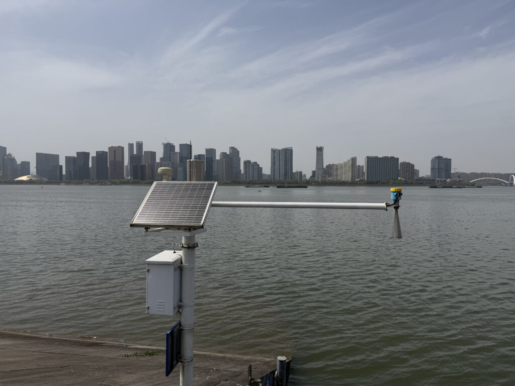
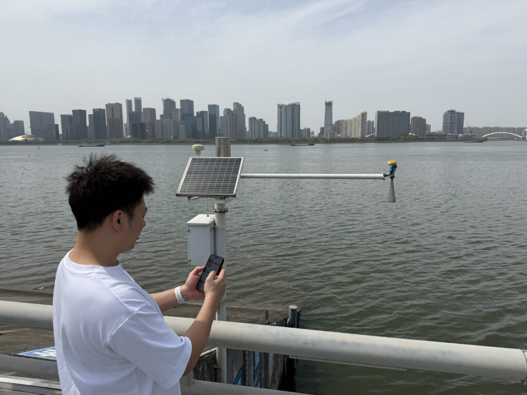
This project is located at the intersection of a river pump station and a natural waterway in a certain city, representing a typical open natural water environment. The site features a wide water surface, significant wave fluctuations, rapid level changes during rainy seasons, and long-term exposure to high humidity and water mist. More importantly, the location has no stable power supply and requires an independent energy system.
Before the upgrade, the monitoring point used ultrasonic and conventional level measurement devices. However, operational issues gradually became apparent: wave motion caused signal fluctuation, moisture interference led to unstable readings, fog conditions in winter increased measurement errors, and frequent maintenance resulted in high operational costs.
Based on these challenges, the project ultimately adopted the JWrada® radar level transmitter from Shenzhen Jiwei Automations Ltd, equipped with a horn antenna structure and integrated with a solar-powered independent energy system, forming a complete outdoor river level monitoring node.
Stable Measurement in Complex Water Surface Conditions
The challenge of river level monitoring is not whether measurement is possible, but whether it remains stable.
In open water environments, the water surface is constantly dynamic. Wind waves, raindrop impacts, and floating debris can all affect echo signals, causing conventional devices to generate unstable or false readings.
In this project, the JWrada® radar level transmitter uses a horn antenna design, which provides a more focused radar beam and reduces interference from edge reflections and cluttered echo zones. In actual operation, even under strong wave conditions, the system continues to lock onto the true water surface signal reliably.
Field data comparison shows that after the upgrade, the water level curve became significantly smoother, abnormal fluctuations were greatly reduced, and overall data continuity was improved.
Solar Power Supply Enabling True Unattended Operation
Since stable grid power is unavailable at the river monitoring site, a solar power supply system was implemented.
The system consists of solar panels, energy storage batteries, and an intelligent power management module, enabling fully autonomous operation. Even during continuous rainy days, the system maintains stable power output.
In addition, the device adopts a low-power operation strategy, automatically adjusting sampling intervals based on water level variation frequency, achieving a balance between energy consumption and measurement accuracy.
This design enables the entire monitoring node to operate in a truly “unattended” mode, significantly reducing the need for manual inspection.
On-Site Operational Performance
After deployment, several significant improvements were observed:
First, data stability was greatly enhanced. Even under strong wave conditions or surface disturbances, the water level signal remained continuous without obvious jumps.
Second, environmental adaptability was improved. In high humidity, fog, and temperature variation conditions, the device showed no noticeable performance degradation.
Third, maintenance frequency was significantly reduced. Due to the non-contact measurement principle, mechanical wear was eliminated, enabling long-term low-maintenance operation.
Overall, the system now operates more stably, making the data more suitable for flood control scheduling and long-term trend analysis.
Role of Horn Antenna in River Level Monitoring

In this project, the horn antenna structure is one of the key optimization factors.
Compared with standard antenna designs, the horn antenna provides stronger beam directivity, effectively reducing multipath reflections over open water surfaces. This is particularly important in river environments characterized by strong reflections and continuous wave motion.
At the same time, its improved energy concentration capability enhances long-distance echo recognition stability, ensuring reliable measurement performance even in wide water surface applications.
System Value: From Measurement Point to Monitoring Node
The significance of this project goes beyond device replacement. It represents a structural transformation from “point-based measurement” to “node-based sensing network”.
By integrating radar level measurement technology, solar power supply, and wireless communication modules, the river monitoring site is transformed into an independent monitoring unit with autonomous operation capability. This architecture enables stable long-term operation in complex natural environments while continuously performing data acquisition and transmission tasks.
At the data level, monitoring information is transmitted in real time to cloud platforms or municipal water management systems, enabling continuous tracking and dynamic visualization of river level changes. Operators can not only access real-time data but also analyze historical trends to identify potential risks earlier, providing more reliable support for flood control and emergency decision-making.
From a system architecture perspective, this node-based deployment significantly reduces reliance on centralized infrastructure. Each monitoring point operates independently with its own sensing, power supply, and communication capabilities, greatly enhancing adaptability and scalability in complex terrains, distributed sites, and extreme weather conditions.
For urban flood control systems, this model represents a shift from centralized monitoring to a distributed intelligent sensing network. It improves coverage, response speed, redundancy, and reliability, enabling higher-quality and higher-density real-time hydrological data for disaster prevention and mitigation.
Conclusion
In open river environments, river level monitoring faces far more uncertainties than industrial tank applications.
The JWrada® radar level transmitter, combined with horn antenna design and solar-powered independent operation, achieves stable performance in complex outdoor conditions.
This project demonstrates that radar level technology is evolving from industrial applications toward natural river level monitoring systems, becoming a key sensing component in smart water management infrastructure.